A Case for a Greenway Extension
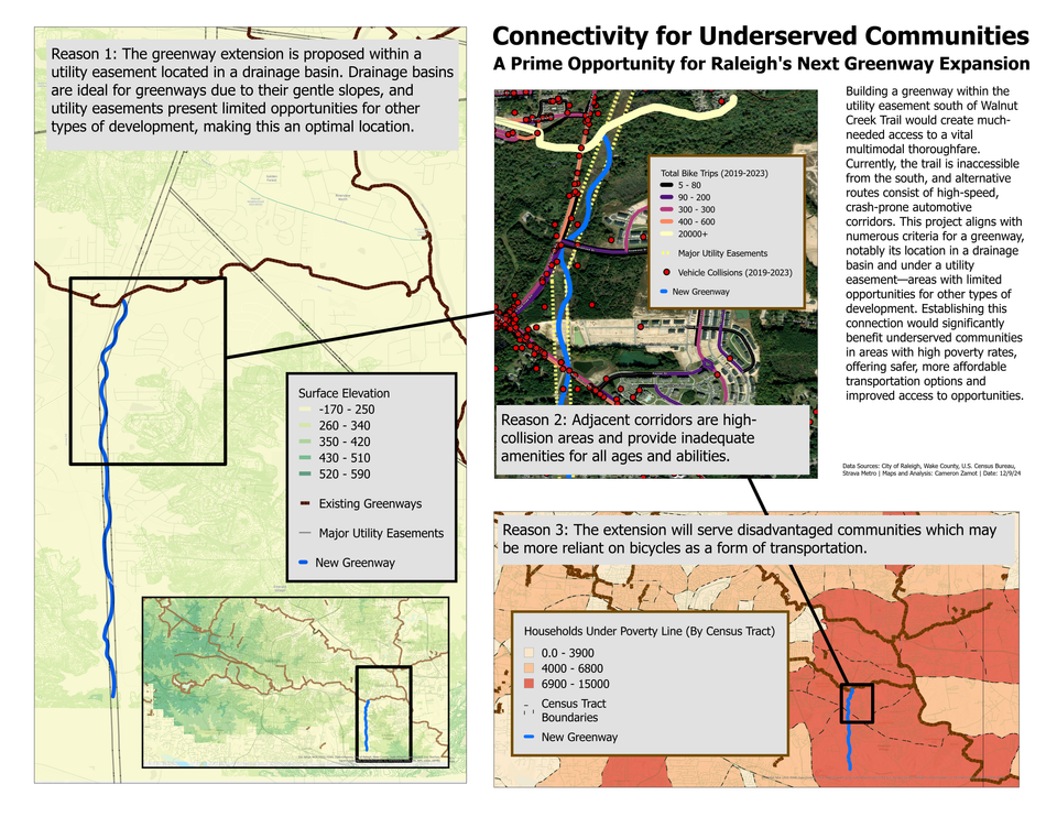
Edit 12/16: The original maps are at the end of the blog post in a gallery. I have updated the post body to include the latest maps.
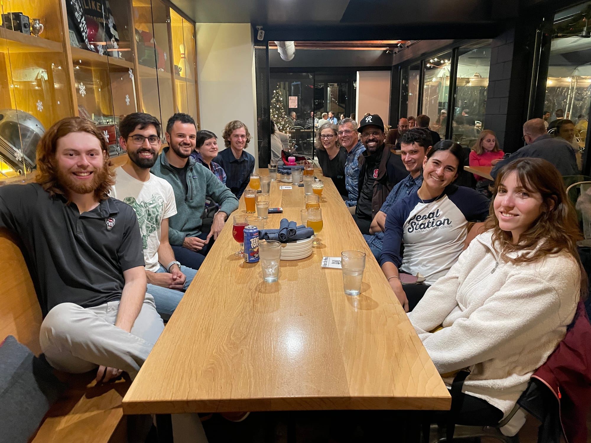
Last night was the City of Raleigh Active Mobility Open House, and it was a blast. TBL partnered with Oaks and Spokes to host a short group ride from Trophy Brewing on Morgan Street over to the Tarboro Community Center and back. There were about 12 of us on the ride, and there were tons of people at the event—overall, a successful evening!
As we were discussing active mobility over some drinks at Trophy afterwards, we started talking about an idea I’ve been considering: a case advocating for prioritizing a small addition to the Capital Area Greenway system, which would provide access from the south to the Walnut Creek Trail near South New Hope Road. This location is an ideal candidate for a new greenway because:
- The overlap of a utility easement and a drainage basin offers optimal geographic feasibility.
- The current workarounds are unsafe.
- It would serve disadvantaged communities, who are more likely to rely on bicycle transportation.
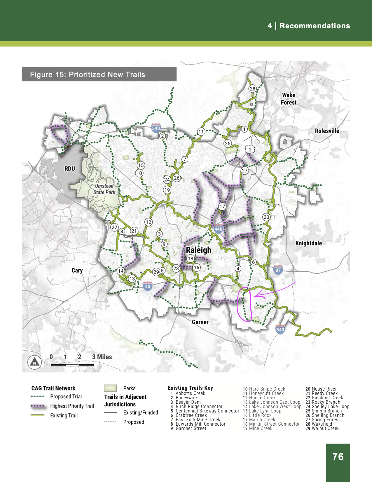
It is actually in the current Capital Area Greenway Master Plan. Below is is a case for prioritizing it.
Reason #1
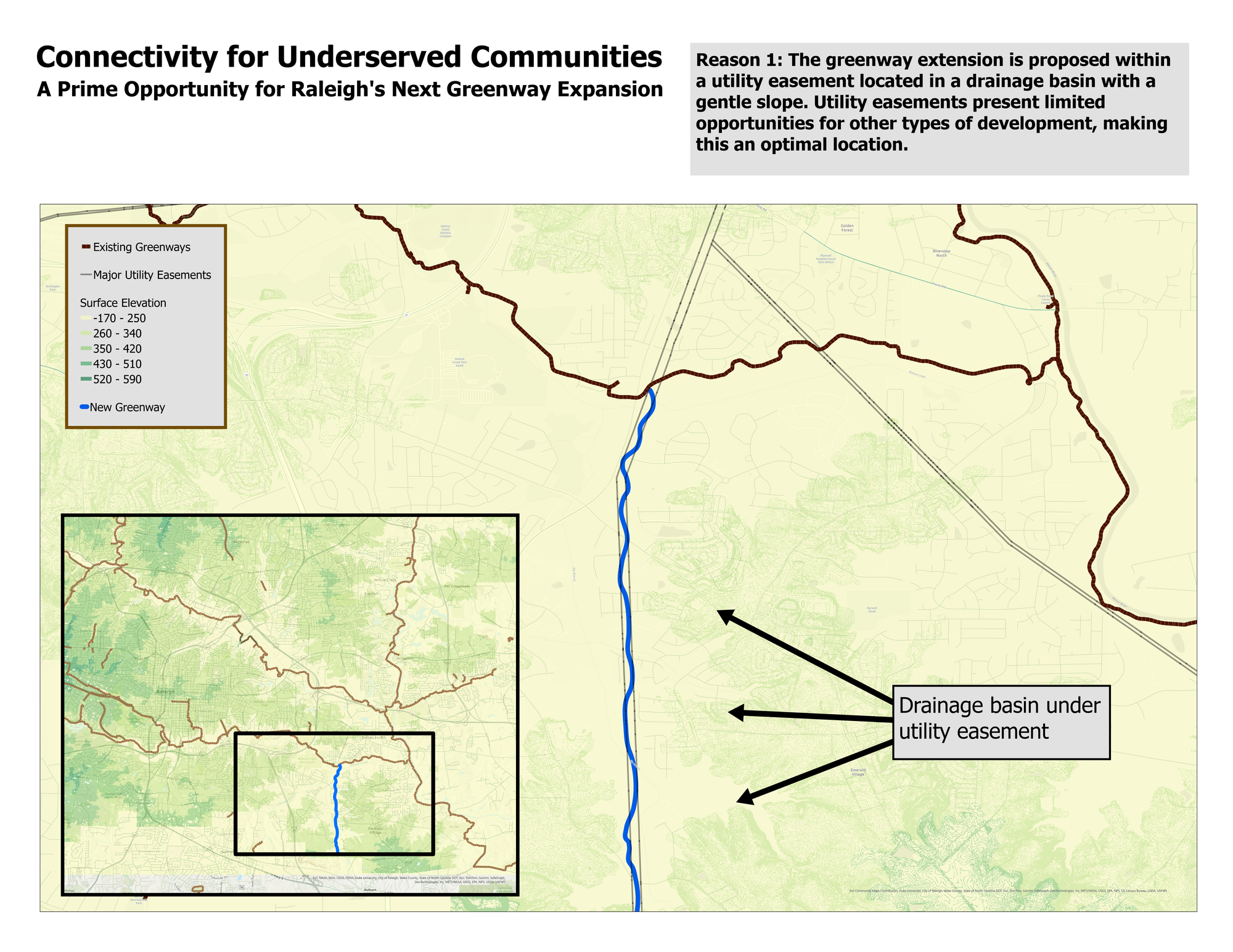
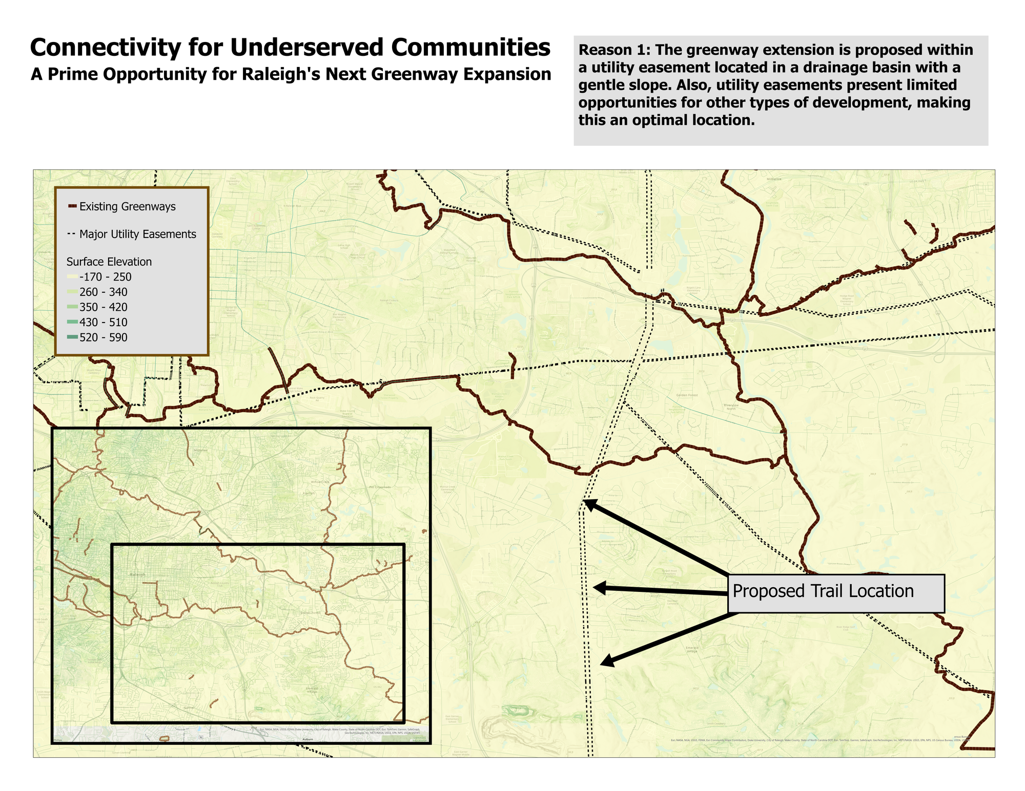
Most of Raleigh's major greenways are located in drainage basins, such as the Neuse River, Crabtree Creek, and Walnut Creek. The area of interest, highlighted below, is situated in a similar drainage basin.
Additionally, the proposed trail location falls under a utility easement. Utility easements are often ideal for greenway development because they have limited alternative uses.
Reason #2
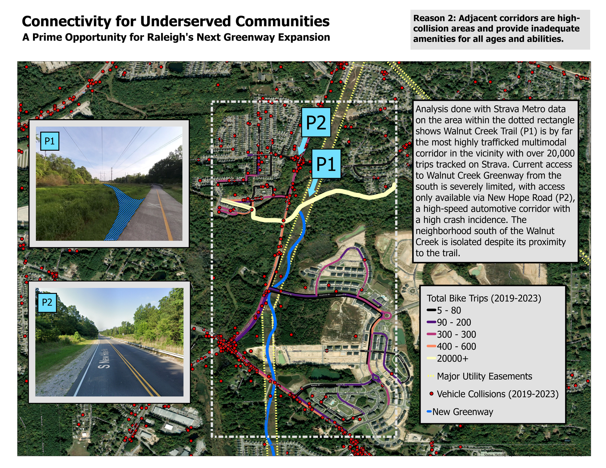
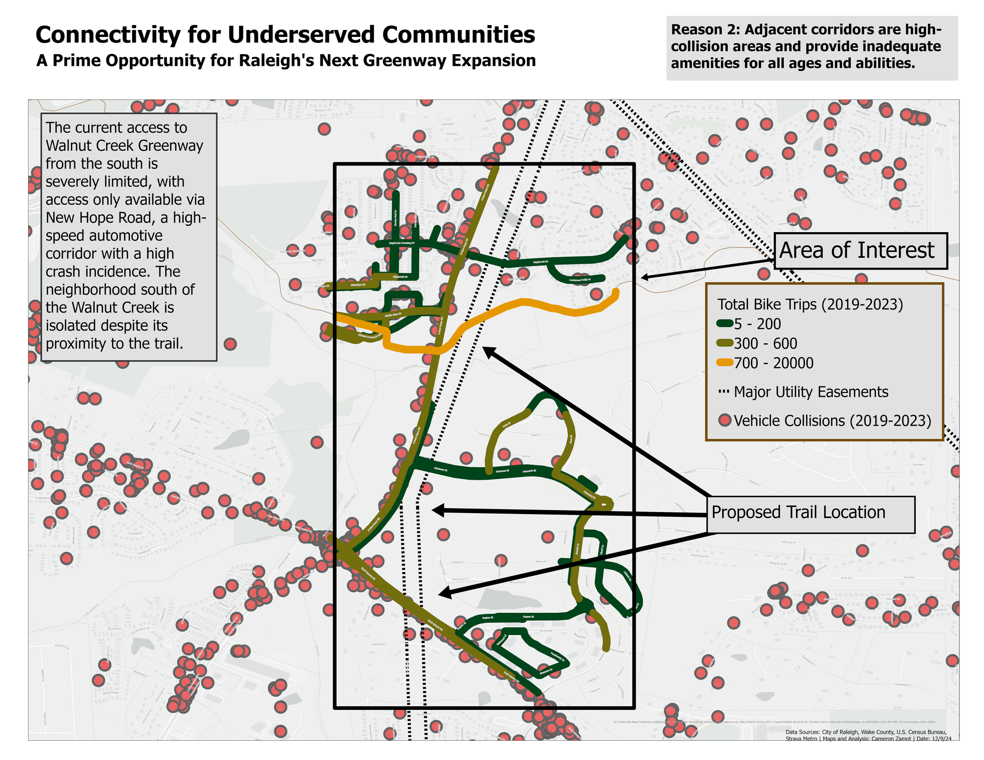
If you live in the neighborhood south of the Walnut Creek Trail and want to access the greenway without driving, your safe options are extremely limited. The most popular route, as shown by the Strava Metro data below, is to use New Hope Road. However, this is a high-speed corridor with numerous auto crashes reported since 2019. The lack of connectivity to the south effectively cuts off these neighborhoods from the greenway.
Reason #3
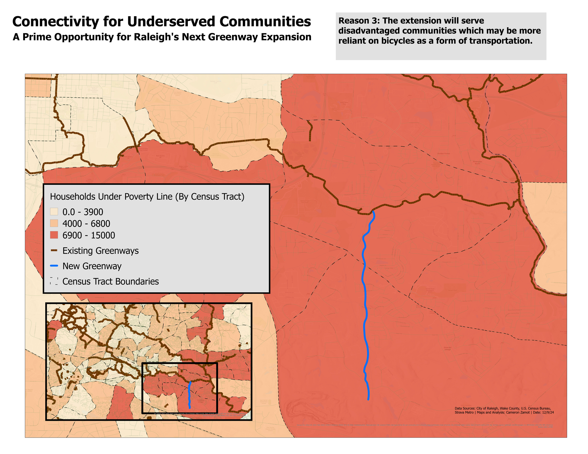
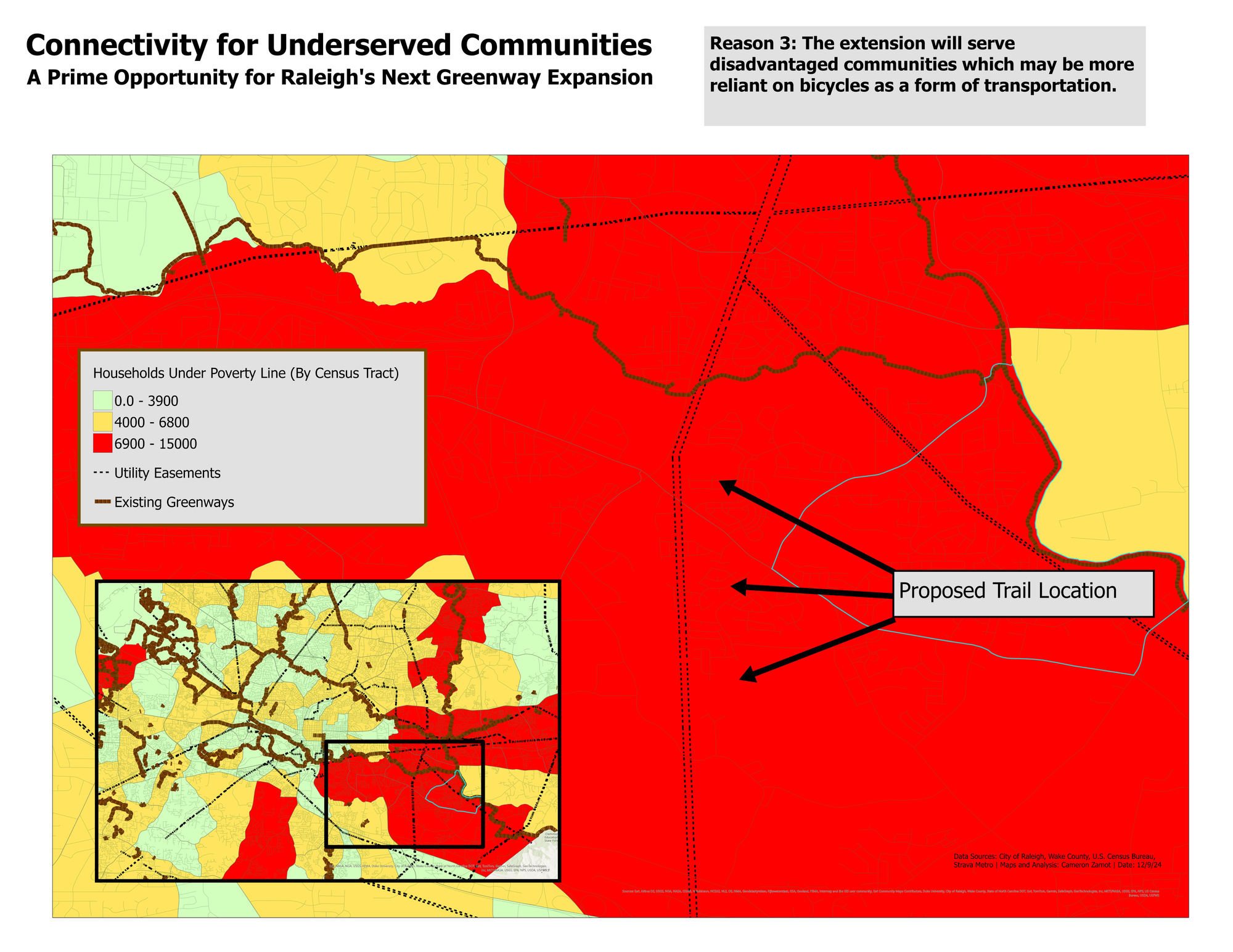
The limited access from the south unnecessarily isolates disproportionately disadvantaged communities. The map below illustrates some income statistics in the surrounding areas. Given that these populations are more likely to rely on free or low-cost transportation, such as bicycles, adding a safe connection to the greenway would provide significant benefits.
Again, this is already in the Master Plan. Hopefully it can get prioritized soon. Cheers to new bike infrastructure!
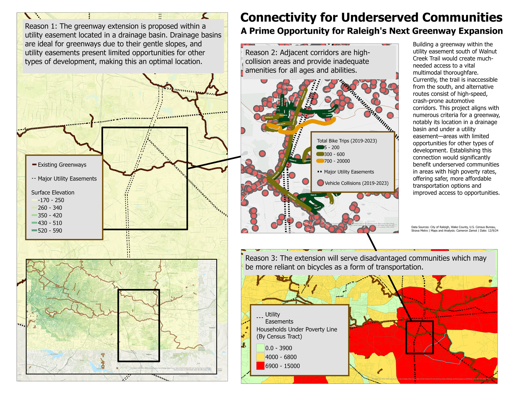
Rough draft maps below:

Comments ()